111 BRIARWOOD DRIVE
Owner Information
KARP JEFFREY R & JACQUELINE R
111 BRIARWOOD DRIVE
TAUNTON, MA 02780


Property Details
111 BRIARWOOD DRIVE is classified as a Single Family Residential (Ranch).
The primary structure on this property was built in 1966. There are 1,889ft2 of built area within this property. There is 960ft2 of residential/living space within this property. This property is listed as having 5 rooms.
111 BRIARWOOD DRIVE is valued at $253,800. The land is valued at $90,800 and the structures are valued at $158,600. There is an additional valuation of $4,400 on this property.
This property is in Zone 3.35. Confirm with local Zoning Board authorities to ensure there are no overlays or other easements on this property.
The most recent deed for 111 BRIARWOOD DRIVE is recorded at the local registrar in Book 26481, Page 159. 111 BRIARWOOD DRIVE was last sold on Friday, November 20, 2020 for $350,000.
Assessment data from fiscal year 2021.
Flood Data
According to the FEMA National Flood Hazard Layer, this property does not appear to be in a flood zone. It may also be in an area not yet reviewed. Nonetheless, confirm this information prior to taking any action.
To view the flood hazards around this property, create a FEMA "Firmette" Map of the area around 111 BRIARWOOD DRIVE.
Broadband Internet Providers
| Provider | Type | Bandwidth (mbps) | |
|---|---|---|---|
| VSAT Systems, LLC. | Satellite | 2 | 1 |
| Viasat Inc | Satellite | 100 | 3 |
| Comcast | Cable | 1000 | 35 |
| Verizon New England Inc. | Fiber | 940 | 880 |
| Verizon New England Inc. | DSL | 5 | 0 |
| GCI Communication Corp. | Satellite | 0 | 0 |
| HughesNet | Satellite | 25 | 3 |
Broadband service provider data from December 2020.
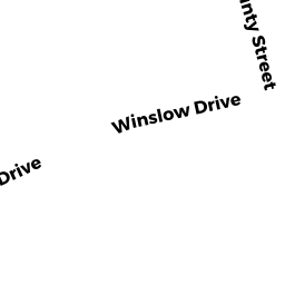
Adjacent Properties
- 840 COUNTY STREET
APT OVER 8 M94 owned by TAUNTON WOODS LIMITED PARTNERS - COUNTY STREET
Vacant, Conservation Organizations (Charitable Org.) owned by WILDLANDS TRUST INC - 101 BRIARWOOD DRIVE
Single Family Residential owned by GOUDY KRISTINE & EFRAIN VEGA - 760 COUNTY STREET
Radio, Television Transmission Facilities owned by PACHECO MARC R